
Books

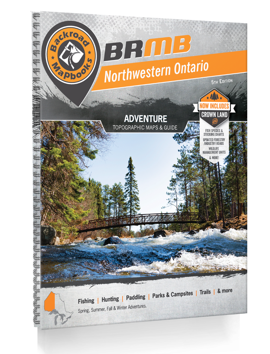


Backroad Mapbooks Northwestern Ontario - 5th Edition
$29.95 CAD
-
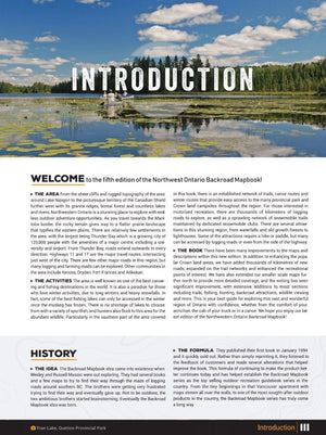
Covering a sprawling wilderness landscape of interconnected lakes, rivers, canyons, hills, forests and wetland, Northwestern Ontario is a massive outdoor playground just waiting to be explored. From paddling to hiking, hunting, fishing, snowmobiling, ATVing, cross-country skiing, camping and more, there is no limit to outdoor activity in Northwestern Ontario. Covering the area around Thunder Bay and Atikokan in the south to the remote wilderness of Opasquia Provincial Park further north and all the way up to Hudson’s Bay, there are endless opportunities for adventure covered in this guidebook.
The 5th edition Northwestern Ontario Backroad Mapbook features ten new larger scale maps as well as numerous additions and expansions from the last edition. These include more fish species, enhanced crown and private land coverage, updated logging and resource roads, countless new Adventure recreational Points of Interest, updated trails and extensive snowmobiling and ATVing additions, making this your ultimate guide to exploring Northern Ontario!
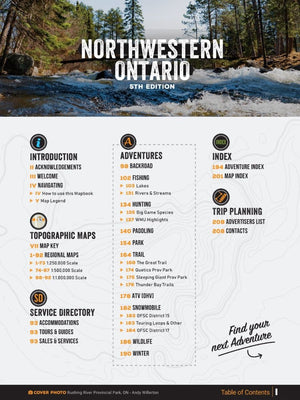
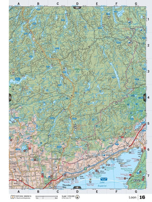
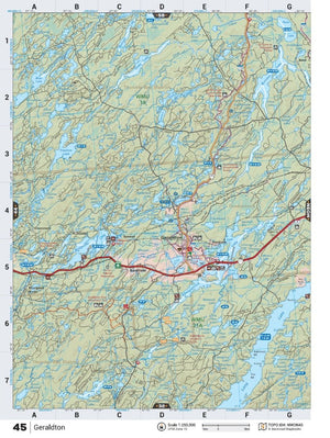
The printed version of the mapbook comes in the convenient 21.5 x 28 cm (8.5 x 11 inch) mapbook format with a heavy-duty spiral-bound cover. The 216 page book includes 92 maps starting at 1:250,000 scale, along with 10 Outdoor Adventure sections, a Service Provider Directory, Map and Adventure Index, Trip Planning tools and more. With over 145,000 kilometres of roads to view including the most complete logging and industrial road coverage available, the books are ideal for navigating on road trips and planning from home.
-
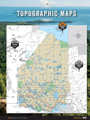
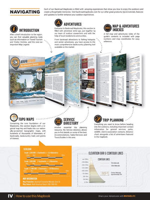
The latest edition of the Northwestern Ontario Backroad Mapbook features 92 detailed topographic maps covering the western part of northern Ontario. These maps contain labelled recreation sites, amenities, highways, backcountry roads, resource roads, trails and other points of interest. Printed on durable paper and protected by a heavy-duty spiral-bound cover, you won't find an easier-to-use or more detailed collection of maps for Northwestern Ontario anywhere!
Service Directory
In addition to the maps, Backroad Mapbooks lists Northwestern Ontario’s best accommodations, services, outfitters and amenities, including information on the region’s best outdoor tours and hunting and fishing suppliers.
Adventures
The detailed adventure section is one of the features that makes your Backroad Mapbook so much more than just a map of Northwestern Ontario. From hiking to hunting, ATVing, camping, paddling, snowmobiling, wildlife viewing and beyond, their team of writers and researchers have come up with the most comprehensive adventure information available anywhere for this region.
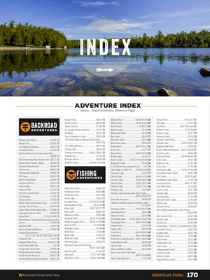
Index
The easy-to-use index is divided into Map and Adventure sections to make it even simpler to navigate. Here you will find page numbers and map coordinates for each activity and location, plus important numbers and websites, and an advertiser list for easy referencing.
Backroad Adventures
Northwestern Ontario is home to endless backroads to explore. Hidden among the many rural and resource roads are man-made and natural attractions, museums, viewpoints, waterfalls, and many other fascinating sites. Whether following a winding backroad or a historic fur trade route, you will find over 40 backroad attractions to stop at in the newest edition of the Northwestern Ontario Backroad Mapbook.
Fishing Adventures
Northwest Ontario is a haven for lake fishing and offers some excellent river fishing as well. Nipigon Lake, Lake Superior and Lake of the Woods house some of Canada’s biggest sportfish. In the latest edition of the Northwestern Ontario Backroad Mapbook you will find over 800, including close to 700 lakes and over 65 rivers and streams, detailed fishing listings for the area, complete with fishing hotspots, fish species, access and stocking information. From stocked trout and splake lakes to walleye, pike and muskie, this book has got you covered.
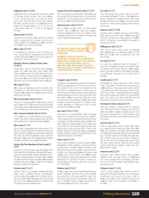
Hunting Adventures
Northwestern Ontario offers massive expanses of wilderness for hunters to explore. These maps detail Northwestern Ontario’s Wildlife Management Units (WMUs) showing you where to go for deer, moose, bear, rabbit, ducks, geese and more. Highlighting over 30 WMUs and helpful tips on all the main game species, from bear to deer and moose, there is no better hunting buddy than the newest northern Ontario mapbook.
Paddling Adventures
Northern Ontario is one of the best wilderness paddling destinations in the world, with countless interconnected lakes, rivers, portages and historical routes – the options for adventure paddling are boundless. In the latest edition of the Northwestern Ontario Backroad Mapbook you will find over 140 detailed paddling adventures, complete with access, put-ins, take-outs, difficulty, highlights and more. From the Atikokan area to Quetico and Wabakimi Provincial Parks, the breadth of canoe routes in the area is second to none.
Park Adventures
Northwestern Ontario’s diverse public park system offers some of the best camping, paddling, hiking, fishing and wildlife viewing you can find anywhere. Many of the parks protect remote, ecologically sensitive areas that make for some absolutely stunning scenery. In the latest edition of our Northwestern Ontario Backroad Mapbook you will find over 130 detailed listings of provincial, national and regional parks as well as conservation areas, including the world renowned Woodland Caribou and Kakabeka Falls Provincial Parks.
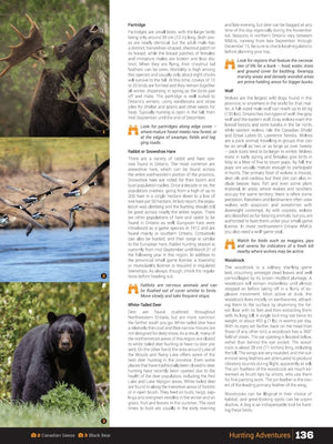
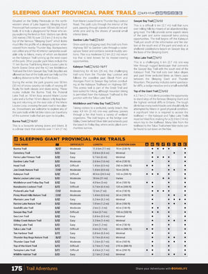
Trail Adventures
From urban walking trails in Thunder Bay to remote wilderness treks around Kenora, there is no shortage of trails to explore in northern Ontario. The Voyageur Trail and the Great/Trans Canada Trail offer some fantastic long distance hiking and biking options. In the latest edition of our Northwestern Ontario Backroad Mapbook you will find over 155 detailed trail descriptions, including access, distance, elevation gain, difficulty, highlights and more. Trail charts offer even more trail alternatives for Sleeping Giant and Quetico Provincial Parks, the Great/Trans Canada Trail and the Thunder Bay area.
ATV (OHV) Adventures
There is a whole world of ATV riding in Northwestern Ontario for you to explore, with the areas around Thunder Bay, Armstrong and Kenora being particularly active. Beyond the 25 featured ATV areas, there are endless amounts of logging and backroads to explore. In the newest edition of the Northwestern Ontario Backroad Mapbook you will find detailed listings for dozens of ATVing areas complete with access, difficulty, highlights and more!
Snowmobile Adventures
Northwestern Ontario is a premiere snowmobiling destination, encompassing OFSC Snowmobile Districts 15 & 17, to help make up one of the world’s largest interconnected snowmobile trail systems. In the latest edition of the Northwestern Ontario Backroad Mapbook you will find over 40 trails or areas highlighted, including snowmobiling areas around Dryden, Kenora, Fort Frances and beyond.
Wildlife Adventures
With such expansive swaths of undeveloped wilderness, Northwestern Ontario is prime wildlife habitat, with moose, deer, wolves, black bear, beaver, otters and more found in abundance. Quetico Provincial Park and Sleeping Giant Park in particular are known for their unique wildlife viewing opportunities. In the newest northern Ontario mapbook you will find almost 45 detailed listings for the best places to view wildlife in the region, complete with tips, specific species to look for and more!
Winter Adventures
From Ignace to Geraldton to Sioux Narrows and beyond, Northwestern Ontario enjoys long winters and heavy snowfalls that make it a winter recreation playground. From downhill skiing and snowboarding to cross-country skiing, fat biking and snowshoeing, there is no shortage of adventure to be had in the wintertime. In the latest edition of the Northwestern Ontario Backroad Mapbook you will over 40 detailed winter adventure listings allowing you to make the most out of this unique region no matter the season!
-
-
Released: 2021
-
Pages: 216
-
Dimensions: 21.5cm x 28cm (8.5" x 11")
-
Map Scale: 73 maps at 1:250K Scale + 14 maps at 1:500K Scale + 5 maps at 1:1,000,000 Scale
-
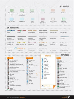
Map Features: Highways, Logging Roads, Land & Water Features, Parks, Adventure Points of Interest, Campgrounds, Hiking Trails, Motorized Trails, Paddling Routes, Hunting & Fishing Areas, Winter Recreation and more
-
Areas Covered: Armstrong, Atikokan, Dryden, Fort Frances, Geraldton, Nipigon, Ignace, Kenora, Pickle Lake, Port Severn, Quetico Park, Red Lake, Sioux Narrows, Sleeping Giant Park, Thunder Bay, Voyageur Trail, Wabakimi Park, Woodland Caribou Park, & more
-
Released: 2021


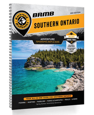


Backroad Mapbooks Southern Ontario
$29.95 CAD
-
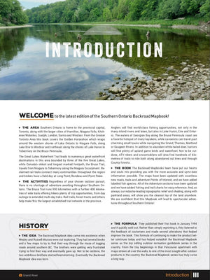
The southern reaches of Ontario contain the vibrant, cosmopolitan heart of Canada, boasting major cities like Hamilton, London and Toronto, the sights of Niagara Falls, and natural attractions such as Wasaga Beach, the world's largest freshwater beach. This Southern Ontario backcountry map book guides your way through the region that is home to Ontario's largest established trail network, hundreds of public parks and conservation areas, the popular Bruce Peninsula, and some of Ontario's most accessible river paddling routes. All of this is just a stone's throw from Canada's most populous region. Let your Southern Ontario backcountry map book show you where to hike, camp, fish, paddle, ski, snowshoe and much more, for outdoor adventures that you will not forget!
The second edition of the Southern Ontario Mapbook features clearly defined Crown land and County Forest Tracts, along with countless updated trails and roads. The Bruce Trail and Trans Canada Trail have been recharted and there are more than 350 other trails highlighted. ATV riders will find several riding areas and snowmobilers can explore over 70 trails through OFSC Regions 4, 5, 8 and 9. In addition, contact information is provided for local ATV and snowmobile clubs. Anglers will find stocking charts and information on 250 lakes and rivers, paddlers can explore 30 lake and river routes, and hunters have maps and descriptions to all 45 WMUs in the area. Rounding out the mapbook are over 40 natural and manmade attractions and museums, National and Provincial Parks, Conservation Areas and over 80 routes for winter exploration.
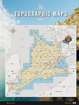
The printed version of the mapbook comes in the convenient 21.5 x 28 cm (8.5 x 11 inch) mapbook format with a heavy-duty spiral-bound cover. The 196-page book includes 65 maps ranging from the highly detailed Point Pelee National Park map to the more traditional 1:150,000 and 1:165,000 scale maps. Complimenting the maps are extensive listings for the 10 Outdoor Adventure sections, local retailers and service providers, Map and Adventure Index, Trip-Planning tools and more. With over 125,000 kilometres of roads to explore, including the most complete logging and industrial road coverage available, the books are ideal for navigating on road trips and planning from home.
-
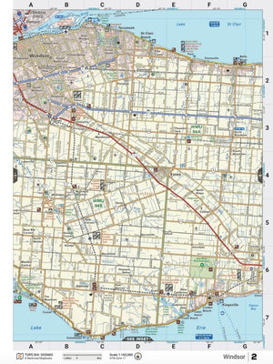
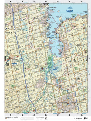
In your durable, heavy-duty, spiral-bound 21.5 cm x 28 cm (8.5" x 11") southern Ontario map book you will find 65 detailed topographic maps spanning the region, complete with labelled recreation sites, amenities, highways, backcountry roads, trails and other points-of-interest. New to this edition is labelled Crown land in the northern region, countless new County Forest Tracts, and labelled fish species for lakes and rivers. Not only are these Ontario maps user-friendly, but they boast a level of cartographic sophistication unparalleled even by government resources making them the maps of choice for search-and-rescue and other organizations.
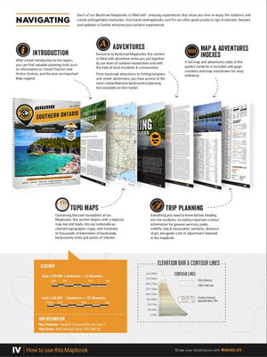
Adventures
The detailed adventure section is one of the features that makes your Backroad Mapbook so much more than a map of southern Ontario. In addition to comprehensive listings with map coordinates, you will find a trip planning section for making notes on your desired adventures! No matter what your favourite outdoor activities are, we have you covered with hundreds of trail descriptions, ATV and snowmobile routes, lake and river fishing details, conservation areas and parks, backroad attractions, wildlife viewing destinations and plenty of spots to strap on ski or snowshoes come winter.
Index
The handy index makes the Southern Ontario Backroad Mapbook a leading Ontario map in terms of functionality as well as quality. Divided into Map and Adventure sections to make it even easier to use, you will find page numbers and map coordinates for each Adventure activity to help locate cities and towns, parks, trails, lakes, rivers and attractions. There is also a section for Important Numbers and an Advertiser list for easy referencing.
-
- Released: 2022
- Pages: 196
- Dimensions: 21.5cm x 28cm (8.5" x 11")
- Map Scale: 65 maps: 33 @ 1:150,000, 31 @ 1:165,000, 1 @ 1:37,000
-
Map Features: Highways, Logging Roads, Land & Water Features, Parks, Adventure Points of Interest, Campgrounds, Hiking Trails, Motorized Trails, Paddling Routes, Hunting & Fishing Areas, Winter Recreation and more
- Areas Covered: Barrie, Brampton, Bruce Peninsula, Cambridge, Chatham-Kent, Collingwood, Guelph, Kitchener-Waterloo, Hamilton, London, Niagara Falls, Oakville, Owen Sound, Sarnia, St. Catharines, Tobermory, Toronto, Wasaga Beach, Windsor, & more