+Brands
- All Camping
- Adventure Lights
- Adventure Medical Kits
- Adventure Ready
- AlpineAire
- Aquatabs
- Backpacker's Pantry
- Backroad Mapbooks
- Ben's
- Big Agnes
- Black Diamond
- Bruce Trail Conservancy
- Chinook
- Chrismar
- Coghlan's
- Counter Assault
- Eagle Creek
- Eno
- Eureka
- Firefly Books Ltd.
- FlipFuel
- Friends of Frontenac Park
- Friends of Killarney Park
- Friends of Temagami
- Gear Aid
- Go-Girl
- Grayl
- GSI
- Happy Yak
- Helinox
- Hotcore
- Humangear
- Hydro Flask
- Jetboil
- JR Gear
- Katadyn
- KIHD Products
- KUMA
- Lat Long
- Light My Fire
- Lone Pine Publishing
- Maps by Jeff
- Marmot
- Massassauga Provincial Park
- MoraKniv
- MSR
- Nalgene
- Nite Ize
- NRS
- nuun
- Ontario Parks
- Opeongo
- Optimus
- Original Bug Shirt
- Penguin Random House Canada
- Petzl
- Platypus
- Pristine
- Red Pine
- Rome
- Sea to Summit
- Sierra Dawn
- Silva
- SOL
- Sterling
- Sven-Saw
- Tender
- Therm-a-Rest
- Tick Key
- Treqa
- UCO
- Ultimate Survival Technology
- Unlostify
- Victorinox
- Wiley Publishing Inc
- World Famous
- Yet-Eh
- Yeti
+

Camping


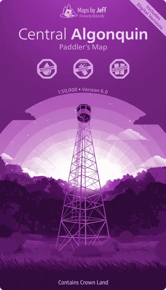


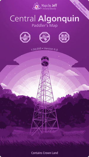

Maps by Jeff Central Algonquin
$24.95 CAD
-
Waterproof, buoyant, and tear resistant is just the tip of the iceberg when it comes to the features of Maps by Jeff.

- Double Sided
- Scale: 1:50,000
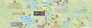
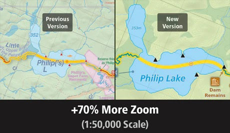
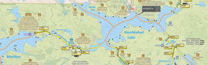
Portage Elevation Profiles:
“At least this portage is short.” Famous last words. It turns out that the hardest portages aren’t always the longest ones – they’re the ones with a mountain or two in the middle. Now, thanks to the portage elevation profiles, you’ll know where the hills are before you go.
We bet you didn't know...- About all of the historical logging ruins scattered across Algonquin
- Exactly which fish species you'll find throughout each lake, river and creek
- Where to find all of the secret unofficial routes that will help you find solitude faster
But now you will - and that's just the beginning.
"Are we there yet!?"
Setting up your tent at 9pm since *someone* overlooked the seemingly endless number of twists & turns on the Tim River is...no fun. There's no need to go through that again though. Now, both rookie and expert trippers alike can quickly and easily plan reasonable trips using the travel times printed on the map.
 This product is made in Canada
 - Double Sided
-


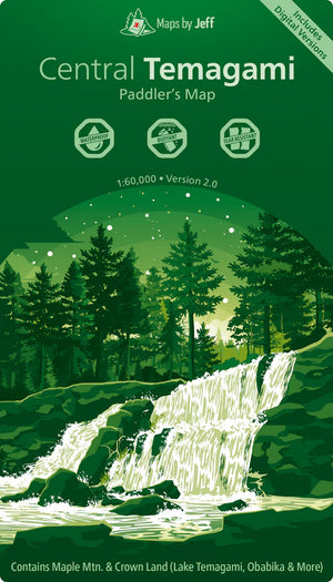
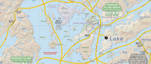

Maps by Jeff Central Temagami
$29.95 CAD
-
Waterproof, buoyant, and tear resistant is just the tip of the iceberg when it comes to the features of Maps by Jeff.
Everywhere you look, you'll find little tidbits of information to help you:- Which portages are particularly tough?
- What creeks have issues with low water?
- Where do paddlers often get confused?
- What trails are hard to find or follow?
…and that's just to start!
Whether it’s your first trip or your 20th, with insights like these you’ll be ready to tackle every twist and turn.
- Double Sided
- Scale: 1:60,000
- Central Temagami Map contains Maple Mountain & Crown Land (Lake Temagami, Obabika & More)
This product is made in Canada - Which portages are particularly tough?
-


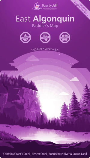

Maps by Jeff East Algonquin
$24.95 CAD
-
Waterproof, buoyant, and tear resistant is just the tip of the iceberg when it comes to the features of Maps by Jeff.
- Double Sided
- Scale: 1:50,000
Portage Elevation Profiles:
“At least this portage is short.” Famous last words. It turns out that the hardest portages aren’t always the longest ones – they’re the ones with a mountain or two in the middle. Now, thanks to the portage elevation profiles, you’ll know where the hills are before you go.
We bet you didn't know...- About all of the historical logging ruins scattered across Algonquin
- Exactly which fish species you'll find throughout each lake, river and creek
- Where to find all of the secret unofficial routes that will help you find solitude faster
But now you will - and that's just the beginning.
"Are we there yet!?"
Setting up your tent at 9pm since *someone* overlooked the seemingly endless number of twists & turns on the Tim River is...no fun. There's no need to go through that again though. Now, both rookie and expert trippers alike can quickly and easily plan reasonable trips using the travel times printed on the map.
This product is made in Canada - Double Sided
-


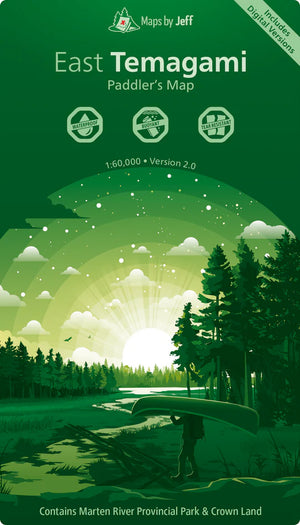

Maps by Jeff East Temagami
$29.95 CAD
-
Waterproof, buoyant, and tear resistant is just the tip of the iceberg when it comes to the features of Maps by Jeff.
Everywhere you look, you'll find little tidbits of information to help you:- Which portages are particularly tough?
- What creeks have issues with low water?
- Where do paddlers often get confused?
- What trails are hard to find or follow?
…and that's just to start!
Whether it’s your first trip or your 20th, with insights like these you’ll be ready to tackle every twist and turn.
- Double Sided
- Scale: 1:60,000
- East Temagami Map contains Martin River Provincial Park & Crown Land
This product is made in Canada - Which portages are particularly tough?
-


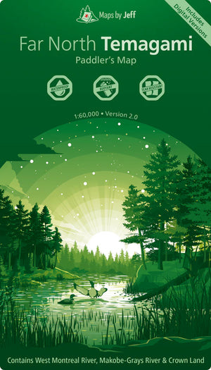

Maps by Jeff Far North Temagami
$29.95 CAD
-
Waterproof, buoyant, and tear resistant is just the tip of the iceberg when it comes to the features of Maps by Jeff.
Everywhere you look, you'll find little tidbits of information to help you:- Which portages are particularly tough?
- What creeks have issues with low water?
- Where do paddlers often get confused?
- What trails are hard to find or follow?
…and that's just to start!
Whether it’s your first trip or your 20th, with insights like these you’ll be ready to tackle every twist and turn.
- Double Sided
- Scale: 1:60,000
- Far North Temagami Map contains West Montreal River, Makobe-Grays River & Crown Land
This product is made in Canada - Which portages are particularly tough?
-

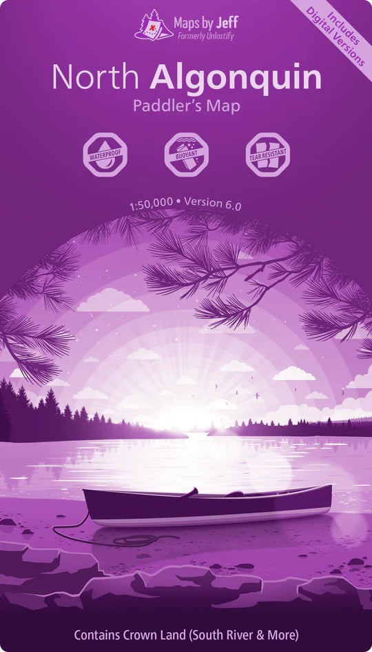


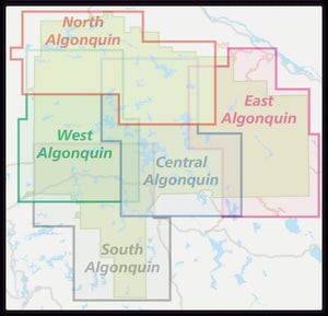
Maps by Jeff North Algonquin
$24.95 CAD
-
Waterproof, buoyant, and tear resistant is just the tip of the iceberg when it comes to the features of Maps by Jeff.
- Double Sided
- Scale: 1:50,000
Portage Elevation Profiles:
“At least this portage is short.” Famous last words. It turns out that the hardest portages aren’t always the longest ones – they’re the ones with a mountain or two in the middle. Now, thanks to the portage elevation profiles, you’ll know where the hills are before you go.
We bet you didn't know...- About all of the historical logging ruins scattered across Algonquin
- Exactly which fish species you'll find throughout each lake, river and creek
- Where to find all of the secret unofficial routes that will help you find solitude faster
But now you will - and that's just the beginning.
"Are we there yet!?"
Setting up your tent at 9pm since *someone* overlooked the seemingly endless number of twists & turns on the Tim River is...no fun. There's no need to go through that again though. Now, both rookie and expert trippers alike can quickly and easily plan reasonable trips using the travel times printed on the map.
This product is made in Canada - Double Sided
-


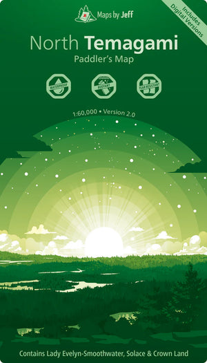

Maps by Jeff North Temagami
$29.95 CAD
-
Waterproof, buoyant, and tear resistant is just the tip of the iceberg when it comes to the features of Maps by Jeff.
Everywhere you look, you'll find little tidbits of information to help you:- Which portages are particularly tough?
- What creeks have issues with low water?
- Where do paddlers often get confused?
- What trails are hard to find or follow?
…and that's just to start!
Whether it’s your first trip or your 20th, with insights like these you’ll be ready to tackle every twist and turn.
- Double Sided
- Scale: 1:60,000
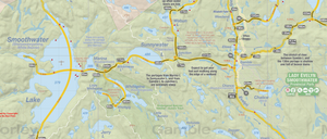
- North Temagami Map contains Lady Evelyn-Smoothwater, Solace & Crown Land
This product is made in Canada - Which portages are particularly tough?
-

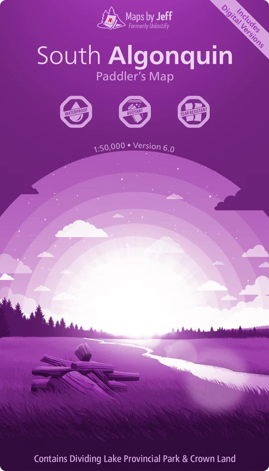


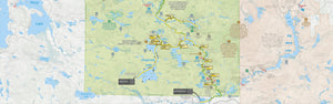

Maps by Jeff South Algonquin
$24.95 CAD
-
Waterproof, buoyant, and tear resistant is just the tip of the iceberg when it comes to the features of Maps by Jeff.
- Double Sided
- Scale: 1:50,000
Portage Elevation Profiles:
“At least this portage is short.” Famous last words. It turns out that the hardest portages aren’t always the longest ones – they’re the ones with a mountain or two in the middle. Now, thanks to the portage elevation profiles, you’ll know where the hills are before you go.
We bet you didn't know...- About all of the historical logging ruins scattered across Algonquin
- Exactly which fish species you'll find throughout each lake, river and creek
- Where to find all of the secret unofficial routes that will help you find solitude faster
But now you will - and that's just the beginning.
"Are we there yet!?"
Setting up your tent at 9pm since *someone* overlooked the seemingly endless number of twists & turns on the Tim River is...no fun. There's no need to go through that again though. Now, both rookie and expert trippers alike can quickly and easily plan reasonable trips using the travel times printed on the map.
This product is made in Canada - Double Sided
-

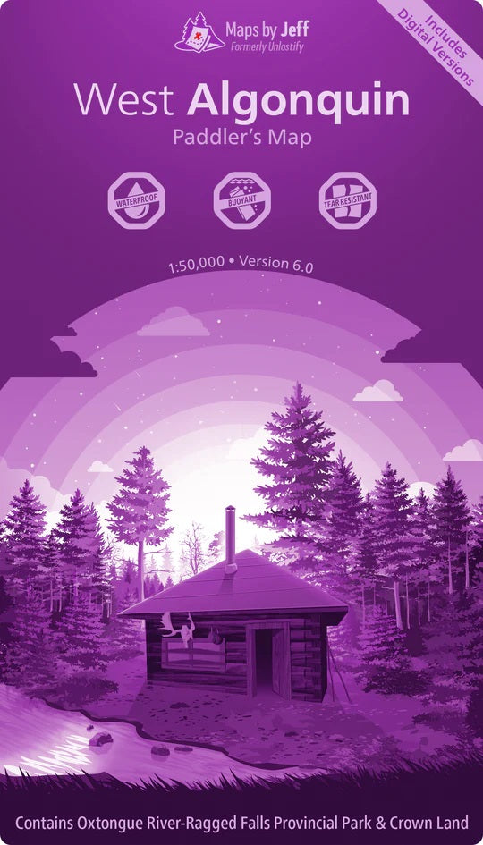


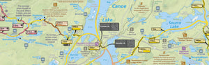

Maps by Jeff West Algonquin
$24.95 CAD
-
Waterproof, buoyant, and tear resistant is just the tip of the iceberg when it comes to the features of Maps by Jeff.
- Double Sided
- Scale: 1:50,000
Portage Elevation Profiles:
“At least this portage is short.” Famous last words. It turns out that the hardest portages aren’t always the longest ones – they’re the ones with a mountain or two in the middle. Now, thanks to the portage elevation profiles, you’ll know where the hills are before you go.
We bet you didn't know...- About all of the historical logging ruins scattered across Algonquin
- Exactly which fish species you'll find throughout each lake, river and creek
- Where to find all of the secret unofficial routes that will help you find solitude faster
But now you will - and that's just the beginning.
"Are we there yet!?"
Setting up your tent at 9pm since *someone* overlooked the seemingly endless number of twists & turns on the Tim River is...no fun. There's no need to go through that again though. Now, both rookie and expert trippers alike can quickly and easily plan reasonable trips using the travel times printed on the map.
This product is made in Canada - Double Sided
-


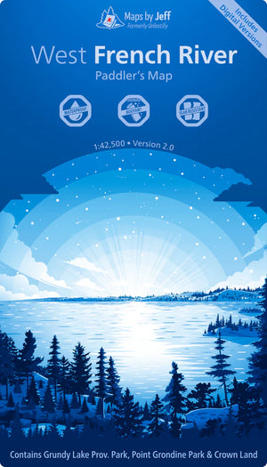
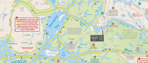
Maps by Jeff West French River
$24.95 CAD
-
Waterproof, buoyant, and tear resistant is just the tip of the iceberg when it comes to the features of Maps by Jeff.
- Double Sided
- Scale: 1:42,500
- The West French River map covers Highway 69 down to Georgian Bay
Portage Elevation Profiles:
While most portages on the French River are fairly flat, there are definitely a few "memorable" exceptions. Now, thanks to the portage elevation profiles, you’ll know where the hills are before you go.
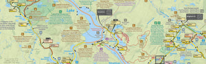
Distances & Travel Times
Each stretch of canoe route is labelled with both the distance, and an estimated travel time.Since we all travel at different speeds over different terrains (e.g. we’re faster on big lakes and slower on portages), they'll help you avoid planning a route that has you arriving at your campsite at 9pm.
Not only do they consider paddling vs. portaging speeds, but they also account for things like:
- The condition of each portage
- How twisty a river or creek is
- Hills on portages
- Obstructions, like swifts and log jams
This product is made in Canada - Double Sided
-


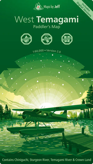
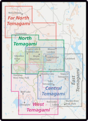
Maps by Jeff West Temagami
$29.95 CAD
-
Waterproof, buoyant, and tear resistant is just the tip of the iceberg when it comes to the features of Maps by Jeff.
Everywhere you look, you'll find little tidbits of information to help you:- Which portages are particularly tough?
- What creeks have issues with low water?
- Where do paddlers often get confused?
- What trails are hard to find or follow?
…and that's just to start!
Whether it’s your first trip or your 20th, with insights like these you’ll be ready to tackle every twist and turn.
- Double Sided
- Scale: 1:60,000
- West Temagami Map contains Chiniguchi, Sturgeon River, Temagami River & Crown Land
This product is made in Canada - Which portages are particularly tough?
-