


Camping
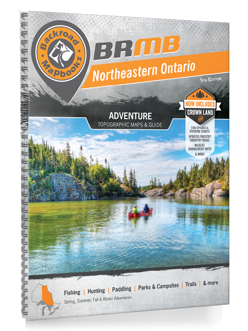
Backroad Mapbooks Northeastern Ontario - 5th Edition
$29.95 CAD
– Sold Out-
Northeastern Ontario is a sprawling region that encompasses much of the Canadian Shield, boasting gorgeous vistas of granite rock, boreal forest and thousands of lakes. Shaped by ancient glacial activity, this wild landscape is full of interconnected streams and rivers, while heading north leads you to the remote and rugged land around Hudson Bay. From the sparkling waters of Georgian Bay to the northern backcountry of Polar Bear Provincial Park, outdoor explorers can enjoy a wealth of opportunity in this sparsely-populated region.
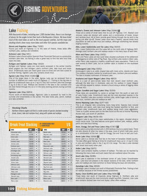
To help you better explore Northeastern Ontario, the Backroad Mapbooks team has created the most comprehensive and detailed recreation Mapbook for the region ever! The 5th Edition Northeastern Ontario Backroad Mapbook contains numerous additions and expansions from the last edition, including labelled fish species and Crown/private land, fish stocking and hiking trail charts, enhanced hiking and multi-use trail routing (including for the Voyageur Trail), countless new recreation Points of Interest and more! Featuring 99 detailed topographic maps, thousands of detailed Adventure write-ups, an easy-to-use index and much more, this is your ultimate guide to exploring Northeastern Ontario!
-
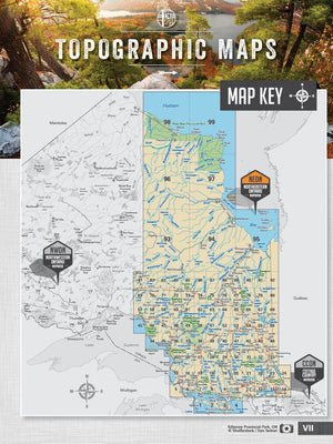
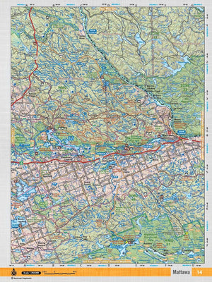
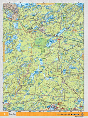
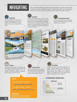
In your durable, heavy-duty, spiral-bound 21.5 x 28 cm (8.5 x 11 in) Northeastern Ontario Backroad Mapbook you will find 99 detailed topographic maps spanning the region complete with labelled recreation sites, amenities, highways, backcountry roads, trails and other Points of Interest. These user-friendly maps boast a level of cartographic sophistication unparalleled even by government sources, making them the maps of choice for loggers and Search and Rescue teams.
Service Directory
In addition to our maps, Backroad Mapbooks lists Northeastern Ontario’s best accommodations, services, outfitters and amenities, including information on the region’s best outdoor tours and hunting and fishing suppliers.
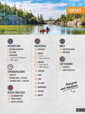
Adventures
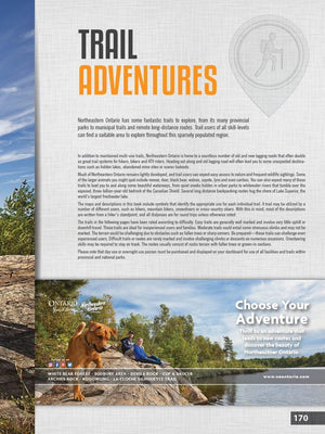
The detailed adventure section is one of the features that makes your Backroad Mapbook so much more than just a map of Northeastern Ontario. From hiking to hunting, ATVing, paddling, wildlife viewing and beyond, our team of writers and researchers have come up with the most comprehensive adventure information available anywhere for this region.
Index
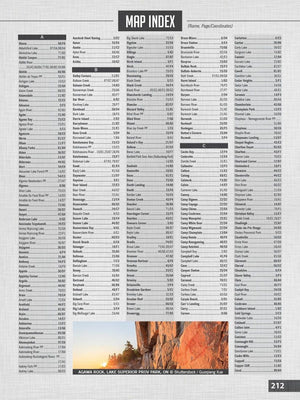
The easy-to-use index is divided into Map and Adventure sections to make it even simpler to navigate. Here you will find page numbers and map coordinates for each activity and location, plus important numbers, distance charts and an advertiser list for easy referencing.
-
- Released: 2018
- Pages: 224
- Dimensions: 21.5 cm x 28 cm (8.5" x 11")
- Map Scale: 68 maps @ 1:250,000, 6 maps @ 1:500,000, 7 maps @ 1:1,000,000
- Regional Cities/Parks: Cochrane, Hearst, Manitoulin Island, Moosonee, North Bay, Sault Ste. Marie, Sudbury, Temagami, Timmins, Wawa, & more