+Shop
- Men +
-
Women
+
- On Sale
- Outerwear
- Fleece Jackets & Tops
- Sweaters & Sweatshirts
- Long Sleeve Shirts
- Short Sleeve Shirts
- Tanks & Camis
- Dresses & Tunics
- Pants
- Shorts & Skirts
- Baselayer
- Performance Underwear
- Sleepwear
- Socks
- Belts
- Sunglasses & Accessories
- Widebrim & Baseball Hats
- Buffs
- Winter Headwear +
- Gloves & Mitts
- Face Masks
- Footwear +
- Paddling +
- Hiking +
-
Camping
+
- Tents +
- Water Treatment
- Kitchen +
- Camp Food
- Sleeping Bags +
- Sleeping Pads +
- Chairs, Cots & Tables
- Hammocks
- Campfire Accessories
- Cord, Straps & Buckles
- Headlamps & Lights
- Solar Power & Batteries
- Saws, Axes & Shovels
- Knives & Multi-tools
- First Aid & Survival
- Insect Protection
- Personal Hygiene & Sunscreen
- Maps & Books
- Games & Gifts
- Travel +
+Brands
- All Maps & Books
- Backroad Mapbooks
- Bruce Trail Conservancy
- Chrismar
- Firefly Books Ltd.
- Friends of Frontenac Park
- Friends of Killarney Park
- Friends of Temagami
- Lat Long
- Lone Pine Publishing
- Maps by Jeff
- Massassauga Provincial Park
- Ontario Parks
- Penguin Random House Canada
- Rome
- Unlostify
- Wiley Publishing Inc
+
Maps & Books


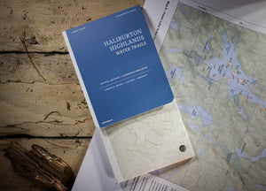
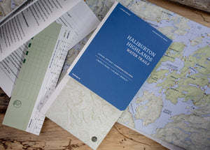
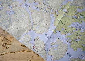
Lat Long Haliburton Highlands Water Trails
$17.95 CAD
-

Rugged and yet accessible, the scenic Frost Centre and Poker Lake areas are the ideal gateway to long weekend wilderness escapades. By way of canoe routes of all difficulties, varied landscapes await, from an old-growth hemlock forest and wetlands teeming with wildlife, to a rare meromictic lake.
Included:- Map 1, printed one side, Frost Centre Area at 1:36,000
- Map 2, printed one side, Poker Lake Area at 1:18,000
- Map notes booklet
- Ruler at scale/bookmark
- All the above inside a map folder
- Map 1, printed one side, Frost Centre Area at 1:36,000
-
- Map 1: Frost Centre Area - Scale 1:36000.
- Map 2: Poker Lake Area - Scale 1:18000.
- Booklet: Map notes, tidily packaged in a map folder. Features campsites, navigation obstacles, trails and portages, points of interest, contours lines, and more.
- Printed on very tough water and tear resistant FSC paper in Canada.
- Printed one side with generous margins. Can be annotated with any pen or pencil, feels like paper.


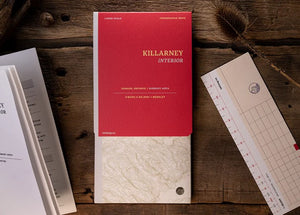
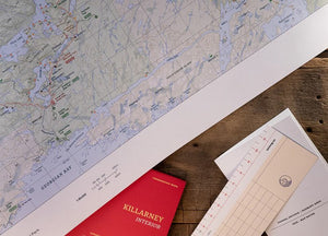
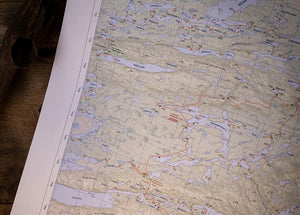
Lat Long Killarney Interior
$21.95 CAD
-

Unspoiled and wild, Killarney’s majestic beauty inspired Group of Seven artists in their art and to take conservation action. Towering over clear lakes, peatlands and oak and pine forests, the La Cloche range and its white quartzite ridges offer a unique background to awe-inspiring canoe trips and unforgettable on-and-off-trail hiking.
Included:- Map 1: printed one side, East, Bell-David, East Panache at 1:65,000
- Map 2: printed one side, West, Northwest Loop at 1:65,000
- Map notes booklet
- Ruler at scale/bookmark
- All the above inside a map folder
- Map 1: printed one side, East, Bell-David, East Panache at 1:65,000
-
- Map 1: East, Bell-David, East Panache - Scale 1:65000.
- Map 2: West, Northwest Loop - Scale 1:65000.
- Booklet: Map notes, tidily packaged in a map folder. Features campsites, trails and portages, points of interest, contours lines, and more.
- Printed on very tough waterproof and tear-resistant FSC paper in Canada.
- Printed one side with generous margins. Can be annotated with any pen or pencil, feels like paper.
- Map 1: East, Bell-David, East Panache - Scale 1:65000.


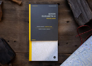
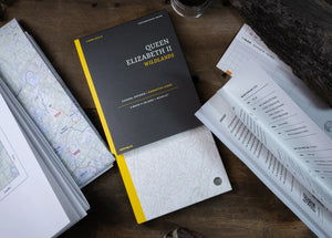
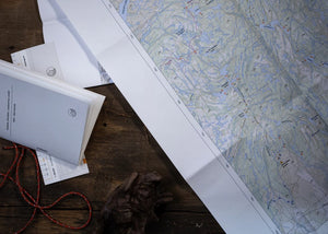
Lat Long Queen Elizabeth II Wildlands
$15.95 CAD
-

Dotted with a network of lakes and rivers, Queen Elizabeth II Wildlands is the second-largest wilderness area in South Central Ontario, procuring unmatched opportunities for backcountry adventures. Its low rolling topography of wetlands and bedrock barrens crowned with forested uplands features over 50 landform vegetation patterns forming an excellent wildlife conservation habitat.
Included:- Map 1, printed one side, Wildlands East at 1:36,000
- Map 2, printed one side, Wildlands West at 1:36,000
- Map notes booklet
- Ruler at scale/bookmark
- All the above inside a map folder
- Map 1, printed one side, Wildlands East at 1:36,000
-
- Map 1: Wildlands East, The Big Loop - Scale 1:36000.
- Map 2: Wildlands West, Black River - Scale 1:36000.
- Booklet: Map notes, tidily packaged in a map folder. Features campsites, navigation obstacles, trails and portages, points of interest, contours lines, and more.
- Printed on very tough water and tear resistant FSC paper in Canada.
- Printed one side with generous margins. Can be annotated with any pen or pencil, feels like paper.


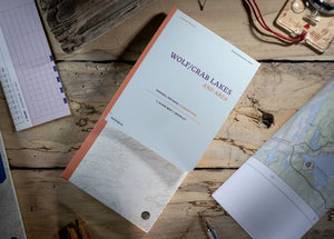
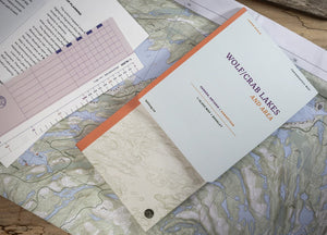
Lat Long Wolf/Crab Lakes and Area
$13.95 CAD
-

Tucked away in beautiful Kawartha Highlands Provincial Park, Wolf and Crab lakes are the ideal short-trip wilderness weekend destination. There is only one short and easy portage separating the two lakes leading to surprisingly secluded campsites, excellent swimming and appeasing scenery.
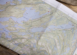
Included:- Map, printed one side, at 1:16,000
- Map notes booklet
- Ruler at scale/bookmark
- All the above inside a map folder
- Map, printed one side, at 1:16,000
-
- Map: Wolf & Crab lakes to Long Lake, Loon Call Lake - Scale 1:16000.
- Booklet: Map notes, tidily packaged in a map folder. Features campsites, navigation obstacles, trails and portages, points of interest, contours lines, and more.
- Printed on very tough water and tear resistant FSC paper in Canada.
- Printed one side with generous margins. Can be annotated with any pen or pencil, feels like paper.


